

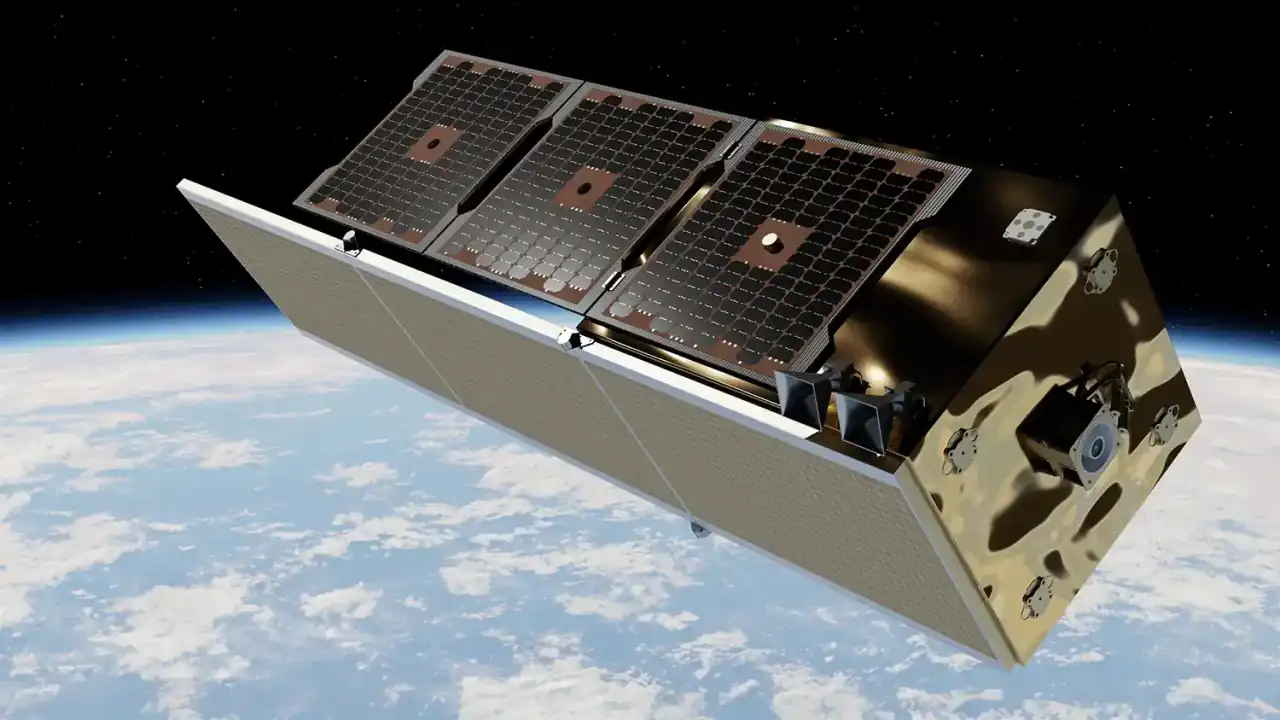
SAR Satellite
End-to-end manufacturing and integration of advanced SAR satellites for independent constellation deployment.
End-to-end designing, manufacturing, and integrating advanced satellites, delivering Earth observation intelligence solutions from orbital hardware to actionable insights for key industries
End-to-end manufacturing and integration of advanced SAR satellites for independent constellation deployment.
Industrially engineered SAR sensors, designed for Seamless integration into compatible satellite buses.
High-resolution optical satellites, fully assembled and integrated for precise Earth observation missions and satellite imagery.





























SARsatX is a space-tech industrial company that designs, develops and operates satellites to do Earth Observation (EO) using Synthetic Aperture Radar (SAR) and optical sensors, delivering high-resolution satellite imagery to support decision makers in several sectors.

To pioneer next-generation full stack earth observation capabilities through Synthetic Aperture Radar and optical sensor technology with artificial intelligence, delivering high-resolution satellite imagery and empowering global decision-making with actionable intelligence from space.

To establish a sovereign space industrial ecosystem in Saudi Arabia that drives innovation, sustainability, and technological leadership to the world.

SARsatX develops advanced satellites with high-performance SAR and optical payloads, leveraging precision-engineered technology through its EarthLife platform to transform high-resolution SAR satellite imagery and all-weather Earth observation data into actionable intelligence
Frequent and reliable monitoring across the MENA region including SAR satellite imagery in Saudi Arabia enabling continuous visibility over critical areas and time-sensitive operations.
Time-aligned SAR and optical satellite imagery combined to deliver deeper insights, clearer context, and more accurate change detection.
An end-to-end ecosystem that connects sensing, tasking, processing, and analytics to turn data into actionable intelligence.
We build cost-effective SAR and optical satellites delivering high-resolution satellite imagery and Earth observation data for rapid change detection across critical applications.
End-to-end satellite system design optimized for SAR missions, ensuring high performance, reliability, and scalable deployment across different observation needs.
Built on radar systems validated in space, delivering consistent, high-quality satellite imagery with excellent signal-to-noise performance and precision.
Advanced mission analysis and orbit determination designed to optimize coverage, revisit rates, and geolocation accuracy for operational use.
Satellite capabilities seamlessly integrated with SARsatX data pipelines and analytics platforms to transform raw signals into actionable insights.
Radar imaging enables continuous Earth observation, independent of daylight and weather conditions, delivering reliable data including satellite imagery where traditional optical imaging falls short.
Radar imaging operates 24/7, enabling continuous Earth observation regardless of daylight or darkness.
Radar technology penetrates clouds, smoke, and adverse weather conditions where optical imaging fails.
Delivers consistent, high-quality satellite imagery and data to support accurate analysis and informed decision-making.

SARsatX delivers reliable, high-resolution SAR data and satellite imagery that enables continuous Earth monitoring and actionable insights across critical industries independent of weather and lighting conditions.
Support exploration, monitoring, and risk assessment for oil, gas, mining, and renewable energy assets.
Provide persistent situational awareness, site monitoring, and activity detection for defense and national security operations.
Monitor maritime traffic, detect illegal fishing, oil spills, and vessel movements with reliable satellite imagery regardless of weather conditions.
Analyze crop conditions, soil moisture, and land use changes using satellite imagery to improve agricultural productivity and resource management.
Enable rapid assessment of floods, earthquakes, and natural disasters to support emergency response and recovery planning.
Track ground deformation, structural stability, and urban expansion to support smart planning and infrastructure resilience.
Change detection insights from SAR imagery supports environmental security forces in identifying illegal deforestation.
Regular SAR data enhancing public safety and regulation through construction, land use, infrastructure, and landslide monitoring.
EarthLife puts mission tasking directly in your hands from space. Our fully automated scheduling system enables users to request new SAR and optical satellite imagery including satellite imagery of Saudi Arabia through a seamless, on-demand self-service interface.

No news articles available at the moment. Please check back later.



















Leverage high-resolution SAR imagery and advanced analytics to gain timely, reliable insights for mission-critical operations across government and commercial sectors.


